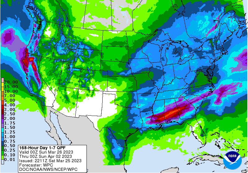
The latest QPF maps for this week show that early in the week, a stationary front draped across central Georgia, Alabama, and South Carolina will bring quite a bit of rain to the region and along the front. Unsettled weather near the front could bring severe weather to that part of the region on Sunday. Mid-week will be fairly dry, and then towards the end of the week a storm will move into the region from the west, bringing a second shot of rain to the region. You can view all the maps at https://www.wpc.ncep.noaa.gov/qpf/day1-7.shtml. The Florida Peninsula will be largely missed by the rain, which could expand drought there again this week.