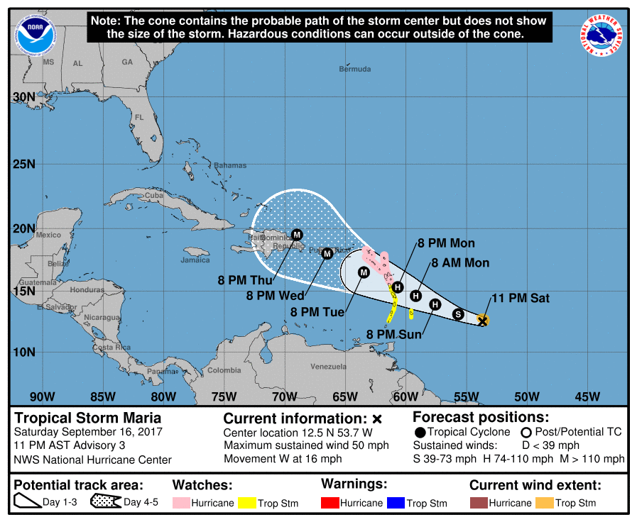
The National Hurricane Center has named two new tropical storms in the Atlantic Ocean today. TS Lee is far to the east in the Atlantic Ocean and is expected to weaken and dissipate without getting close to land. TS Maria is headed to the west and could cross the same region of the Caribbean as Hurricane Irma did earlier this month. Worse, it could be nearly as strong as Irma and that could mean further devastation for the island nations there, including Puerto Rico where it could hit as a major hurricane by Wednesday.
After that we are outside the skill of the computer models used for forecasting. But at least some (although not the majority) of models suggest the potential for a hit on the Atlantic coast, although it is almost impossible that it could get into the Gulf with the projected steering currents. There is plenty of time to watch this without too much worry–at earliest it would start to affect the mainland US by next weekend or in the last week of the month. But I did want to make you aware so that you can keep an eye on things as they develop. And don’t forget Hurricane Jose, which is currently wandering around in the Atlantic but is projected to move north off the East Coast and could brush Cape Cod if it hugs the far west side of the forecast cone. Jose is already bringing large waves and dangerous rip currents to the East Coast. Interesting times in the tropics!