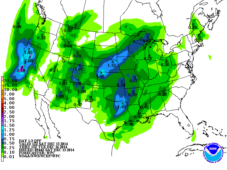
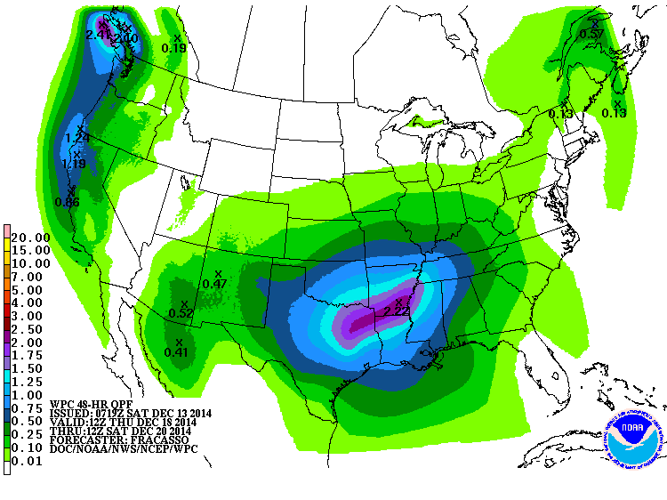
The QPF maps for the US show that the Southeast has two chances for rain in the coming week. Both of them have the highest chance of occurring in the northwestern part of the region. The Florida peninsula is not expected to get any rain from these systems. The first shot will come on Monday night into Tuesday morning, and the second will come late in the week on Friday into Saturday. You can read the effective dates on the captions at lower left on the figures. Updated figures are available at https://www.hpc.ncep.noaa.gov/qpf/day1-7.shtml. Since temperatures are expected to be above normal for most of this period, the precipitation should fall as rain, not snow or ice, except perhaps in higher elevations.