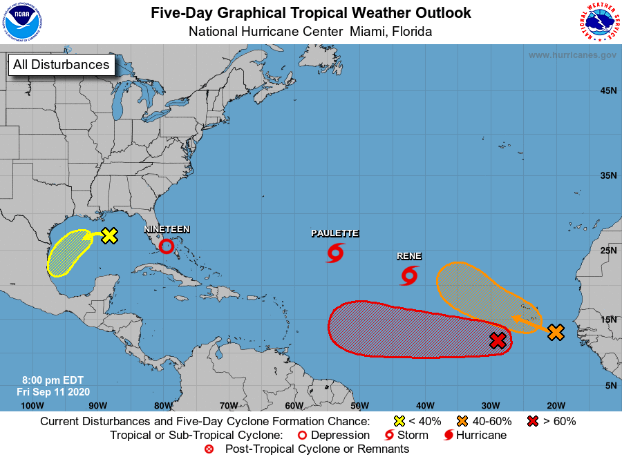
Add another tropical depression to the long list of storms in the Atlantic this year. TD 19 is expected to move across southern Florida in the next 24 hours and then move NW across the Gulf while strengthening to a tropical storm (most likely named Sally) before making landfall as a minimal TS mid-week somewhere between Apalachicola FL and the TX-LA border early next week. It could bring flooding rain to a lot of Florida and northern Gulf Coast as well as gusty winds and potential tornadoes and some high waves and storm surge along the Florida and northern Gulf Coasts. You can get more information at https://www.nhc.noaa.gov/refresh/graphics_at4+shtml/024455.shtml?cone#contents.
At the same time, the season continues to be very active, with Paulette and Rene still present in the central Atlantic and two likely new storms related to tropical waves which recently came off of Africa. They will be storms to watch, although most of them are not likely to make it all the way to the US.

.