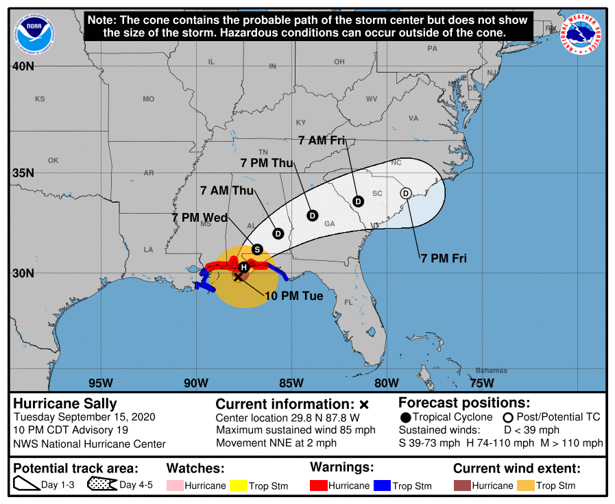
As of 11 pm Tuesday night, Hurricane Sally is creeping north towards the east side of Mobile Bay in Alabama. It is expected to make landfall over the next few hours, but timing is tough when it is only moving at 2 mph. The slow movement is piling up water to the east of the center and adding to the total massive rainfalls that are occurring around the storm but especially on the north side. Otherwise, the forecast for the path of Sally as it weakens to a tropical storm and then depression have not changed much, with heavy rain still expected in a band just to the north of the circulation as it moves off to the north and then northeast. The timing of the storm’s movement through Alabama and Georgia has picked up just a bit, so impacts will occur a little earlier than previously forecast. Follow the National Hurricane Center for forecasts on the storm track and your local National Weather Service Office for local conditions.