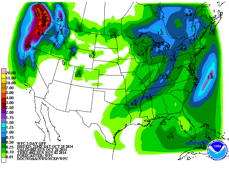
The 7-day QPF map shows that most of the Southeast is expected to get less than a quarter inch of rain in the next week. Most of that will fall during a cold front passage Tuesday night to Thursday afternoon. Other than the scattered showers associated with the front, conditions should be mostly dry. Ahead of the front we can expect temperatures to rise above normal and will probably reach the low 80s in many locations early in the week. After the cold front passes, temperatures will drop significantly. Some models are even hinting at temperatures in northern Georgia in the 20s by next Sunday morning. However, that is at the far range of predictability for weather models, so the weather that actually occurs could be quite different. Keep paying attention to your local forecasts if frost will adversely affect your operations.