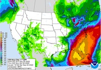
The latest 7-day QPF map is heavily impacted by today’s forecast of where Hurricane Ivan is likely to go based on one model. It shows that areas along of and to the east of the track of the storm may be hit by several inches of rain while areas to the west of the track may see much less if any rainfall. Because the path of the storm is currently evolving, that means this week’s map may end up being good or bad depending on how good the forecast for the storm track is. For now, anyone who is in the forecast cone or to the north of it where it is likely to expand over time should be prepared for periods of heavy rain and wind. That means you should make sure farm equipment and livestock are not in low-lying areas and that if crops are harvested they are not likely to be adversely affected by wet conditions. Of course, this could still change, so you should expect some further adjustments in the storm path and location of impacts. If the storm track moves west, as it has been trending today, then the area of heavy rain will also move to the west following the path of the storm.