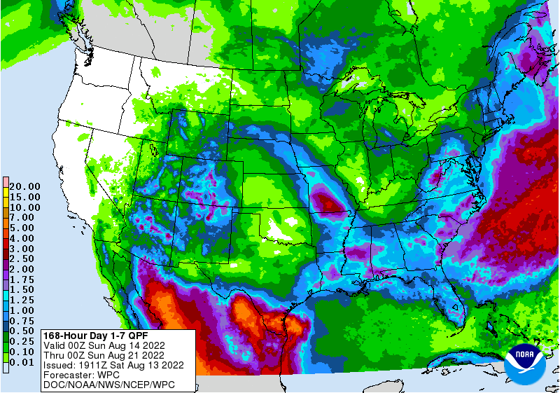
The latest 7-day QPF map shows that most areas within the region should receive some rain this week. In most cases, they are predicting 0.5 to 1.5 inches. Slightly heavier amounts in eastern North Carolina and along the coast with the possible spin-up of a low along the old stationary front that could enhance the rainfall. That is most likely to happen late in the week. In the meanwhile, enjoy the cooler and drier conditions associated with a dry cool front that has been moving into the area from the northeast today. Scattered showers will be likely farther south in the region close to where the front is located. The tropics continue to be quiet with the layer of African dust stabilizing the atmosphere.