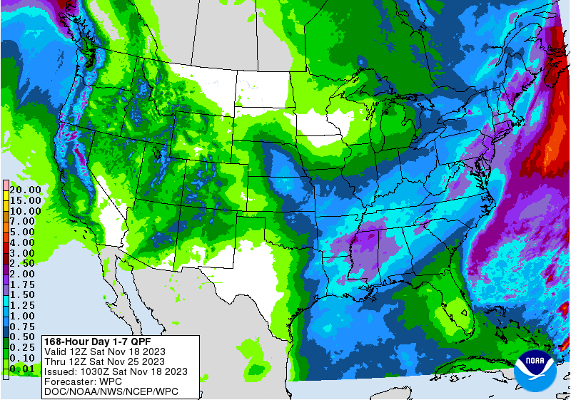
The latest 7-day QPF map shows that rain in midweek will provide some relief to areas that are currently experiencing exceptional drought, but areas to the south down into Florida will see much less rain so any relief there will be limited. The long-term pattern continues to show us moving into a period of more frequent and heavy rain, which should continue to erode the drought in the coming weeks. Thanksgiving weekend could be fairly cold after the passage of a strong front mid-week that is bringing the rain.