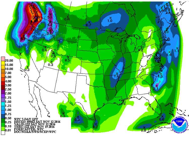
The latest 7-day QPF shows that parts of the Southeast may get a little rain later this weekend in conjunction with the development of a coastal low pressure center off the East Coast, but amounts are expected to be light. The rest of the week will be dry, but we could see a rainmaker come through next weekend as the weather shifts to a more typical autumn-like pattern and a cold front moves through the region. Keep in mind that when you are already dry, the lack of soil moisture can weaken the frontal rainfall, so we may not get a lot out of it, but any improvement in the soil moisture will help down the road as we go into winter.