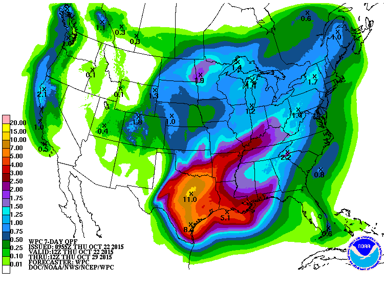
After a good couple of weeks of dry conditions, it appears that the large-scale pattern may be shifting back to one of more regular rainfalls. High pressure has dominated the weather here recently, bringing sunny skies and dry conditions to mostly happy farmers. The ones I’ve seen have been busy out in the fields harvesting as much as they can.
In the next week, the heaviest rain area is focused on Texas, where recent drought conditions are likely to fall under the onslaught of up to 11 inches of rain. While I don’t expect to see this much rain in the Southeast, the pattern should eventually shift east and bring us back into a period of rain storms moving through the area, punctuated by dry spells between the storm systems. Chances go up and look good for rain next week. As always, watch current weather forecasts for details on the timing of the rain.