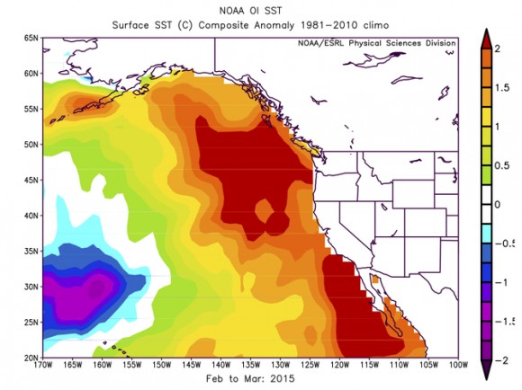
EarthSky had an interesting article this week on how a ‘blob’ of unusually warm water in the Pacific has been changing weather patterns for the last year.
This pocket of warm water is in the central Pacific and is separate from the warm water along the equator associated with the present El Nino, although the two areas interact in affecting our weather. The graphic below shows warm water anomalies off the West Coast in February and March 2015. A persistent ridge of high pressure over the western US helped produce these warm anomalies, and the presence of the warm water has helped lock the weather patterns across the United States in place for the last few months.