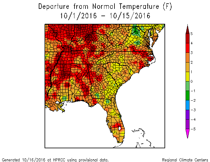
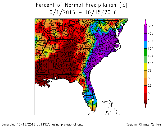
With October half over, it’s time to see how we are doing so far. The temperature departure map shows that almost all of the Southeast is significantly above normal in temperature. The coolest areas are where rain from Hermine fell last month, but even those areas are near or above normal. The drought-stricken parts of the region generally the hottest, which is expected due to low soil moisture levels. Rainfall so far this month has been feast or famine. I’ve chosen to show precipitation as a percent of normal to show how stark the variation across the region is, with large parts of the area receiving essentially no rain since the start of October.
For the rest of this month, we can expect cooler temperatures late next week but after that a return to above normal temperatures is likely. The cooler temperatures will come with some rain, but dry conditions are expected again after that, which is not good news for farmers hoping for more rain.