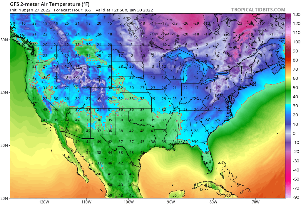
I wrote yesterday about the potential two nights of frost that may cause problems in southern Georgia, Alabama, and Florida this weekend. The latest forecast shows just a slight improvement in overnight temperatures on Friday night into Saturday morning, with the cold air taking a bit longer to move into the region than was predicted yesterday. The forecast for Saturday night into Sunday morning still looks very cold and dry, and freeze watches have now been issued all the way into the Florida peninsula. Please watch your local forecasts if you are worried about how low temperatures could go on those two nights before it starts to warm up again, since the models are still showing some disagreement on exactly how low we will go.