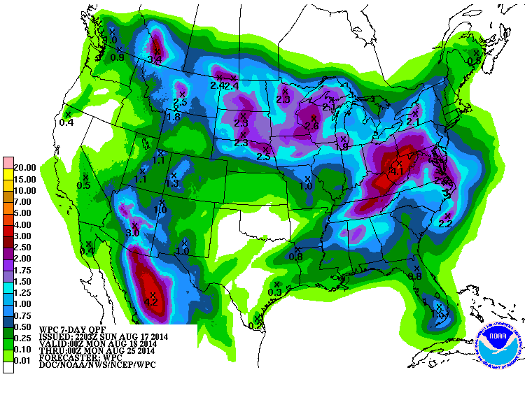
After the next couple of days of scattered thunderstorms, drier than normal conditions are likely to return to the Southeast. Forecasts for the next two weeks show that although some rain may be expected, amounts are generally going to be below average conditions. That, coupled with warm and humid temperatures in the 90s, could lead to an expansion of the small area of D1 drought that has developed in southeastern Georgia near Alma. The tropics show little sign of activity at this time so are not expected to provide any significant relief on the short term. Dryland farmers are starting to feel the pinch of below-normal soil moisture conditions, particularly across south Georgia and Alabama and extending down into Florida.