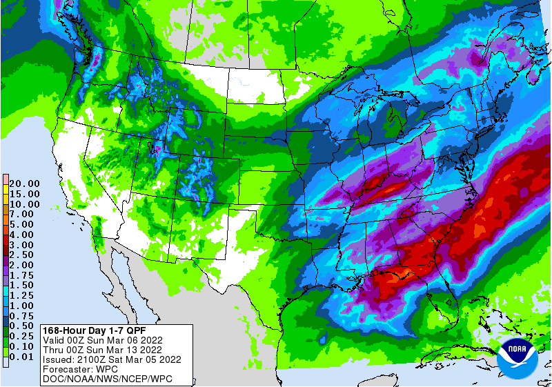
Unlike the last couple of weeks, the coming seven days should be a good deal wetter for most of the region with the exception of southern Florida. A front will move into the region by Monday afternoon and progress towards the southeast over the next few days, stalling out near the coast by late in the week. This front will drop a good bit of rain as it moves through the region, but since it will stall out before it moves through the Florida peninsula, they will miss the needed moisture. You can expect that the drought status will remain the same and may improve in some areas depending on the timing of the rain, but things could get worse in downstate Florida due to the lack of rain there. Also watch for the possibility of some severe weather as the front approaches early in the week.