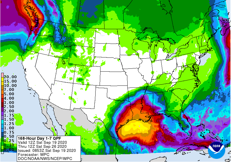
Yesterday we added three named tropical storms to the list–Wilford in the central Atlantic, Alpha near Portugal (!) and Beta in the Gulf of Mexico. Blowoff from TS Beta is currently providing cloud cover to parts of the Southeast, including Alabama, Georgia, and the Carolinas. TS Beta is expected to slowly gain strength to a hurricane and to move NW towards Texas before taking a sharp right turn and hugging the northwest Gulf coast. As it comes back towards the Southeast, we will be in the southerly flow ahead of the circulation, and that will bring moisture and associated clouds and rain to Alabama by the end of the week. It is too far out to know where it will go after that, but at this point in time we think it will be mainly a rain issue for western parts of the Southeast. Stay tuned to the National Hurricane Center for updates as the week progresses, though, just in case.