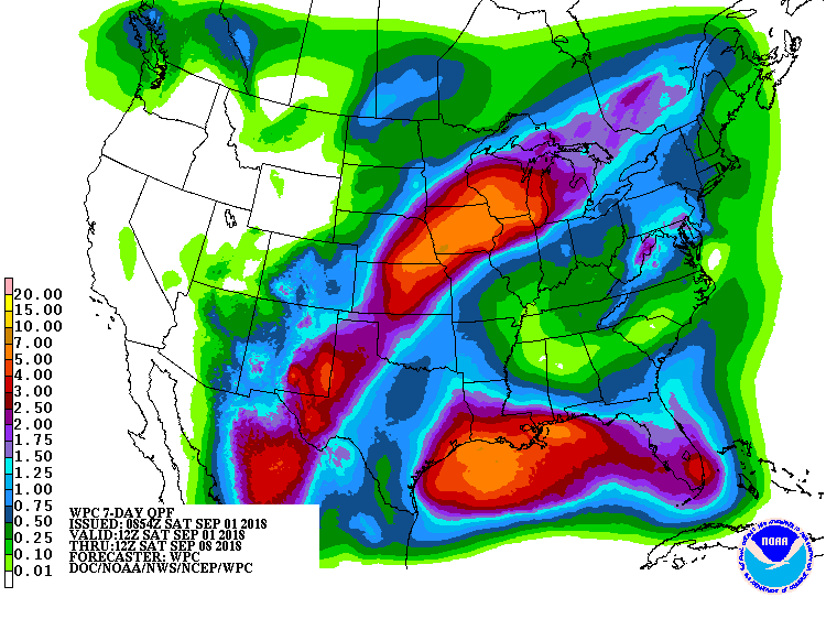
The latest 7 day QPF map shows that for a large part of the Southeast, there will be little rain in the next week. Great news if you are trying to harvest, but maybe not so good if you are still trying to fill pods or keep your crops going for a few more weeks. The Drought Monitor could show some increases in abnormally dry conditions in their next map on Thursday.
Chances for rain will slowly increase over the week, but those are likely to be hit-or-miss. A tropical wave moving into Florida from the southeast may bring rain to the Florida peninsula over the next few days. As the wave moves into the Gulf of Mexico, it could develop into a tropical system but most of the rain associated with that will likely be to our west.