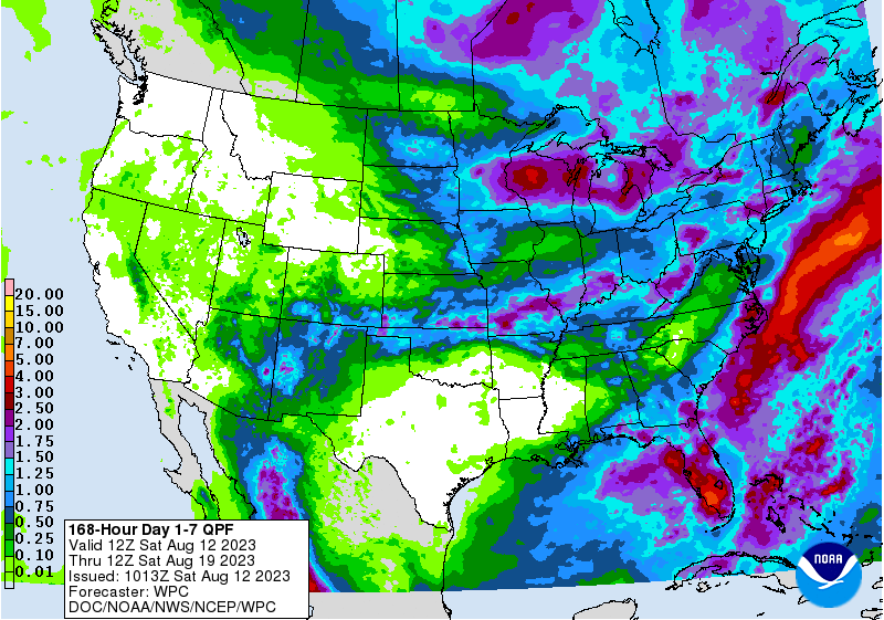
The latest 7-day QPF map shown below indicates that while most of the Southeast will get some rain, amounts in areas north of the Fall Line will be quite light. The highest chance of rain in Alabama and northern Georgia this week will be today, Saturday, and then will diminish to near nothing by Monday. The next few days will be relatively dry across the coastal areas but then rain chances will increase by Monday as a front stalls over the coastal plain, and rain chances there continue to be high through next Friday. You can look at daily maps for days 1-3 then maps for days 4-5 and 6-7 at https://www.wpc.ncep.noaa.gov/qpf/day1-7.shtml.