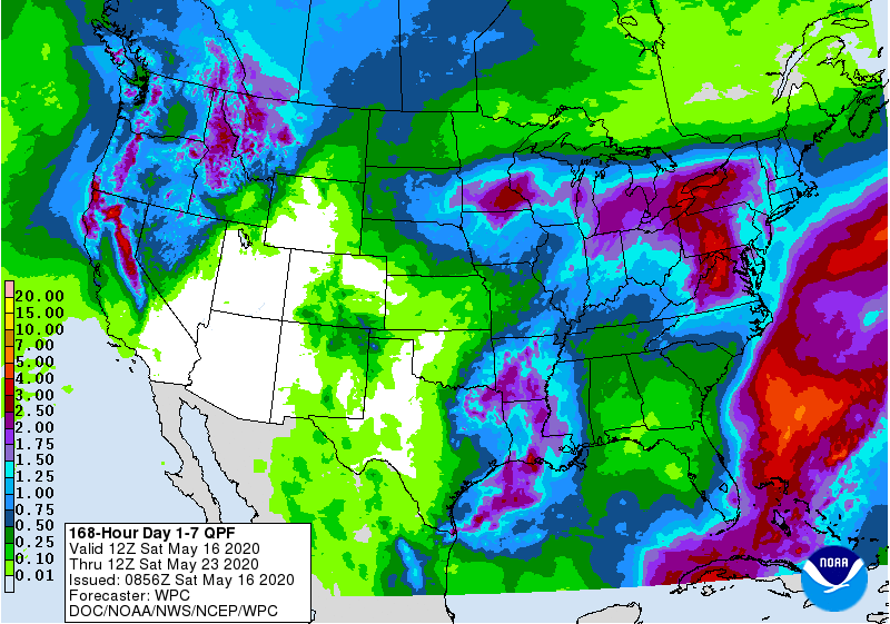
The latest 7-day QPF map shows that most rain that occurs this week in the Southeast will occur on the edges of the region. A developing tropical system is currently bringing some rain to South Florida and will move to the northeast over the next few days. Not much rain is expected from this system once it leaves Florida, although a few showers could occur along the East Coast. A cut-off low that moves into the region from the northeast around the circulation of the tropical system will bring rain to Virginia and North Carolina, but the amounts farther south will be fairly limited. The 8-14 day forecast also predicts warmer and drier conditions than normal for Week 2.