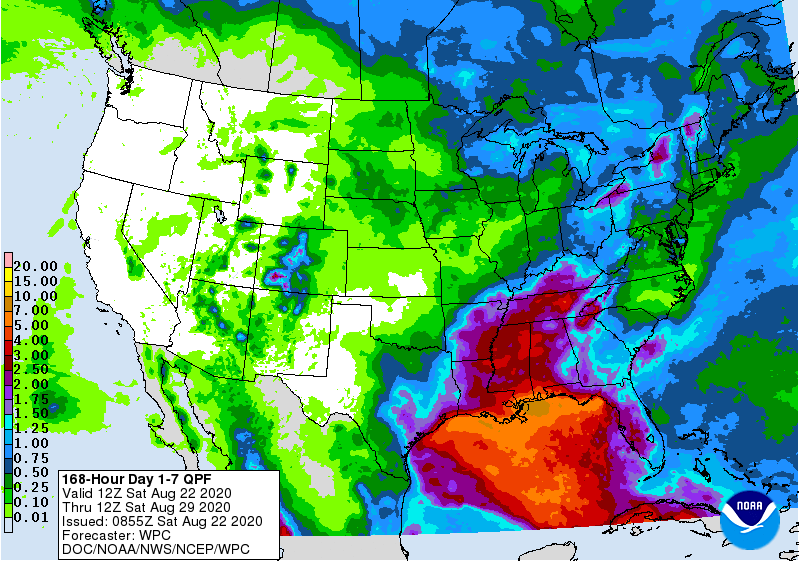
With two tropical storms expected to be in the Gulf of Mexico this week, it should be no surprise that most of the rain we are likely to get is linked to those two rainmakers, especially in the states near the Gulf. This morning’s 7-day QPF map shows that there is a lot of rain expected along the coast, with lesser amounts inland. It is important to keep in mind that this is based on today’s track maps of Laura and Marco, and if those change, the areas of heaviest rain will also shift. Rainfall early in the week will be near the Gulf, while later in the week it will be more inland in northern Alabama and Georgia and up the Appalachians as the storms move into the mid-latitudes. The driest areas are likely to be eastern NC and VA.