The content on this page is retained only for recordkeeping, historical reference, or research. These materials are preserved in their original form and may not meet current WCAG 2.1 AA accessibility standards.
These archived materials are not required to be remediated. However, we remain committed to equitable access. If you need an accessible version of any archived item to participate in our current programs and services, we will provide one when feasible upon request at caesweb@uga.edu.
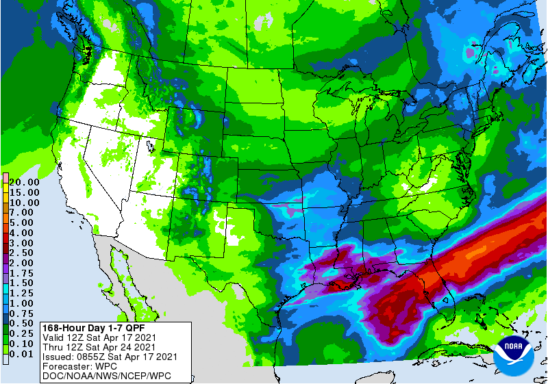
The latest 7-day QPF map shows that the rain this week will be concentrated in a band running through the northern half of the Florida Peninsula along a stationary front there. Areas north and south of the front will stay mostly cool and dry, although some showers cannot be ruled out. By Thursday and Friday next week rain will start to return to western parts of the region as the next storm begins to develop in the Western Gulf.