The content on this page is retained only for recordkeeping, historical reference, or research. These materials are preserved in their original form and may not meet current WCAG 2.1 AA accessibility standards.
These archived materials are not required to be remediated. However, we remain committed to equitable access. If you need an accessible version of any archived item to participate in our current programs and services, we will provide one when feasible upon request at caesweb@uga.edu.
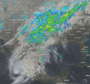
This combined satellite and radar image today shows the moisture streaming northeast from Tropical Storm Sandra into the front draped through Texas and points northeast. Fortunately for the Southeast, most of this moisture will not affect us but could cause flooding in the central US.
Sandra is the strongest hurricane to hit so late in the year in the Eastern Pacific. You can read more about it at Weather Underground here.