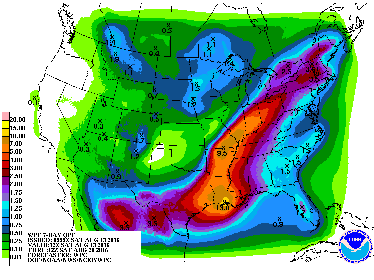
The latest 7 day QPF map shows that most of the Southeast should get a moderate amount of rain over the next week. Most areas are projected to get about one to one and a half inches. Keep in mind that this is only a forecast. Last week’s forecast was woefully incorrect, as the slowly spinning low pressure center, moved west faster than expected and brought the heaviest rain to Mississippi and Louisiana. Some stations there received 20 inches in the last day!
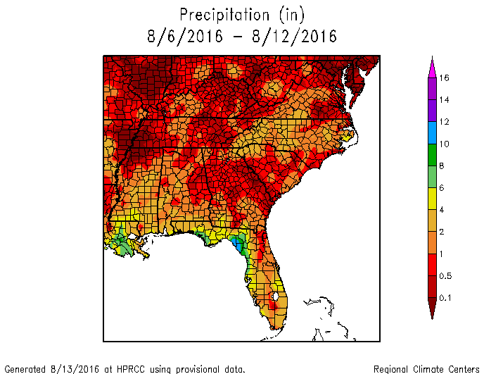
For comparison, here is last week’s forecast and what was actually observed, from the High Plains Regional Climate Center. The pattern was actually not too bad for the eastern part of the Southeast, but it missed the dry conditions that occurred in north Georgia and eastern Alabama.