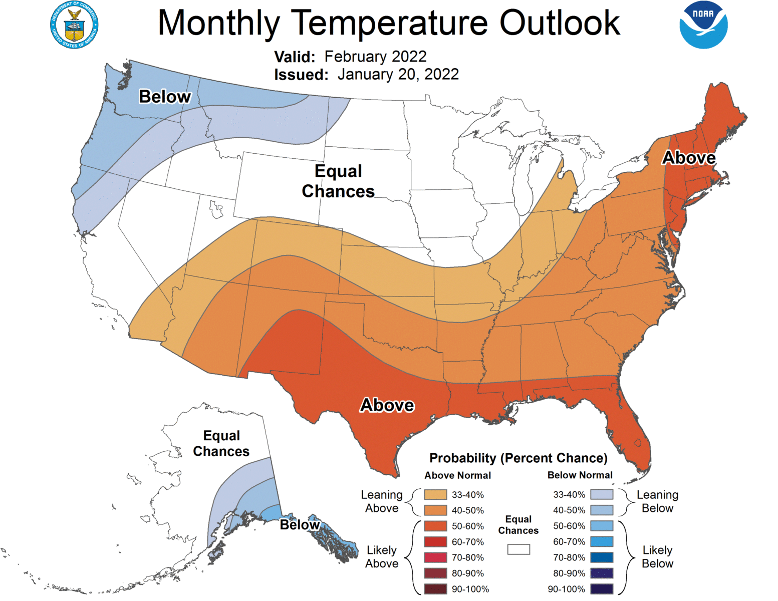
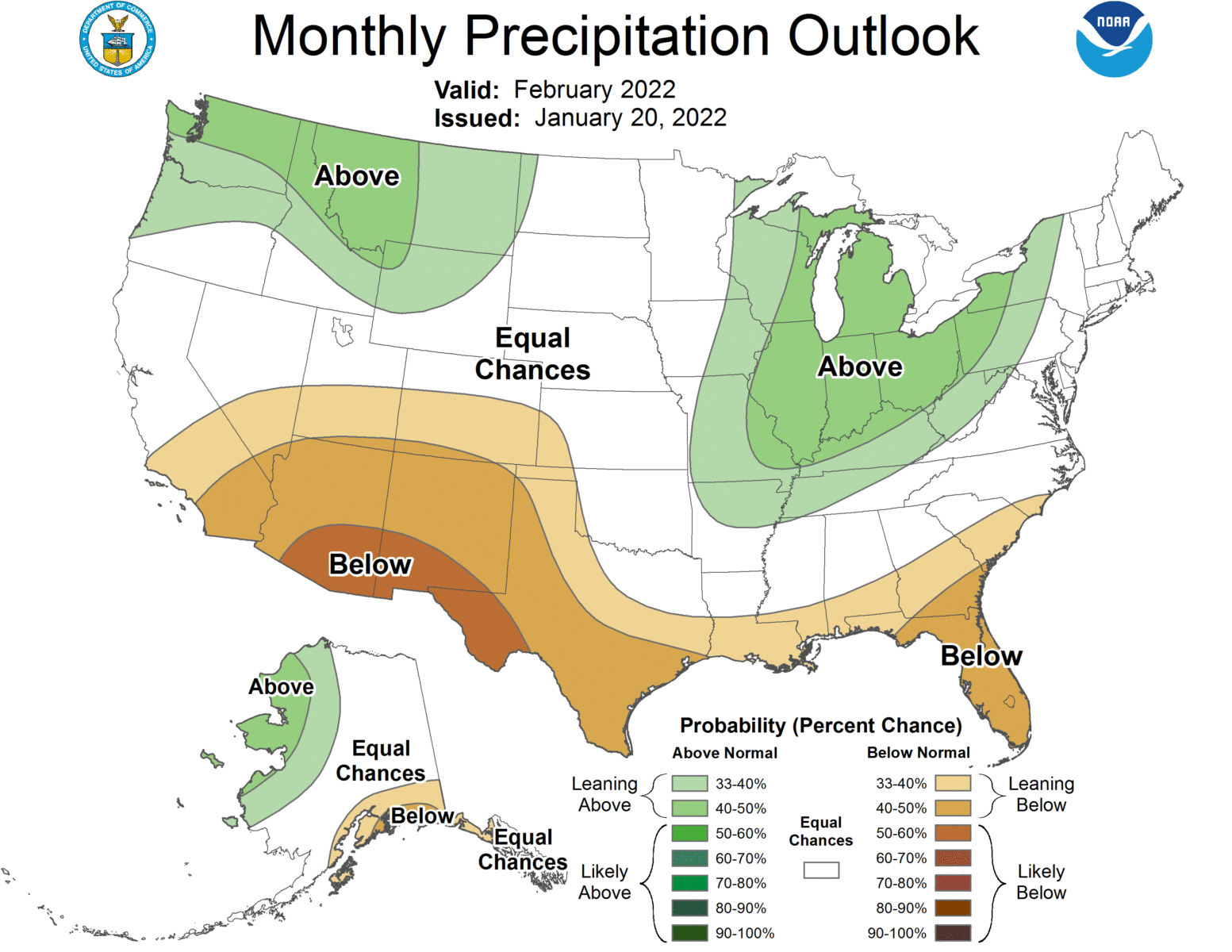
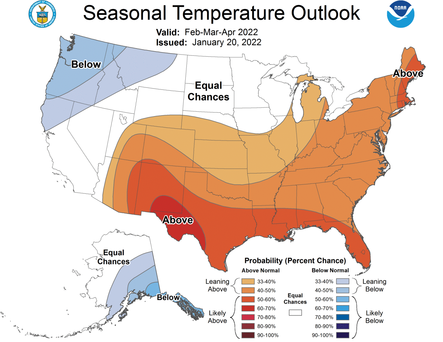
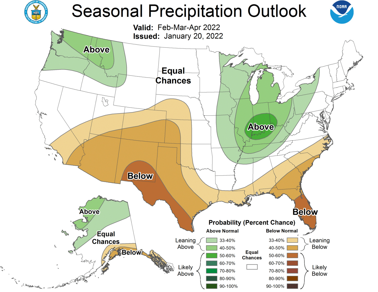
The latest monthly and seasonal climate outlooks were released today. They show a pattern that is very typical of a weak to moderate La Niña, with warmer and drier than normal conditions expected in most parts of the Southeast but especially along the Gulf Coast and in Florida. The result is that the seasonal drought outlook is predicting drought could form in Florida and along the Atlantic and Gulf Coasts this spring. You might not think this today because of all the cold conditions we have had lately, but the long-range models are starting to hint at a big warm-up in the eastern US in early February as the trough of cold air shifts to the western US and we fall under a warm ridge of high pressure. This should occur around the beginning of February and could last for most of the month.