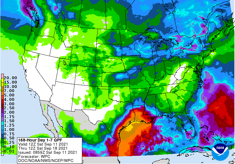
High pressure will dominate the circulation in the Southeast this week. It is bordered in Florida by a stationary front that is bringing some rain to the Gulf Coast and the Florida Peninsula but the rest of the region should be dry for the next three days, and only light and scattered rain showers will occur during the week. The focus of attention is on the western Gulf, where a tropical disturbance is expected to bring heavy rain to western Louisiana and coastal Texas. At this point it is not clear that it will even be named, although it could certainly happen with the warm water in the Gulf. Once the disturbance gets onshore, it may start to bring some moisture back into the Southeast, but it is not expected to be a big rainmaker here. Two other areas of interest in the eastern Atlantic may develop into storms but it will be a long time before they get near enough to affect us, if they do at all.