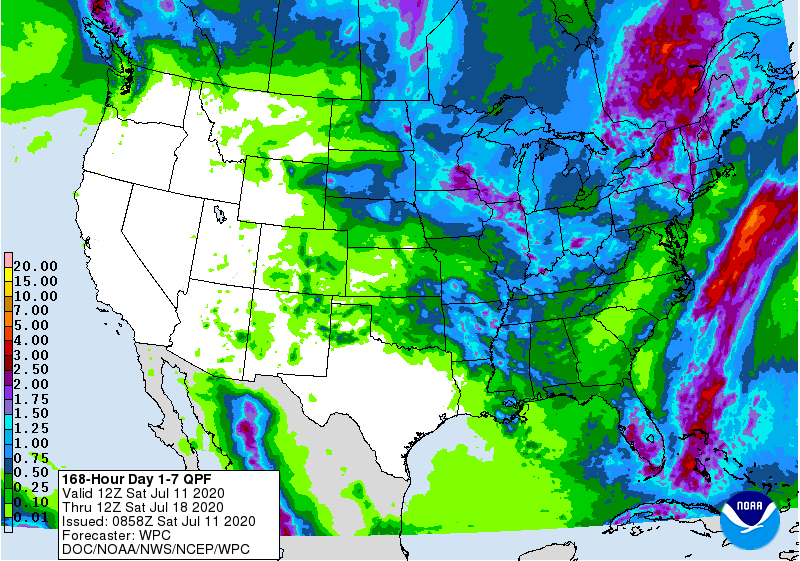
The latest 7-day QPF map shows that most of the Southeast should get less than half an inch of rain this week along with above-normal temperatures. The exception is the Florida peninsula, which is expected to get at least an inch. Most of our rain will stay off the East Coast, so other than widely scattered showers it should be a good week to get field work done. The tropics are continuing to remain quiet now that TS Fay has moved up into New York, not at all unusual for mid-July. The following week is also expected to be fairly dry with temperatures well above normal, although it won’t be as bad in the Southeast as in the mid-section of the US.