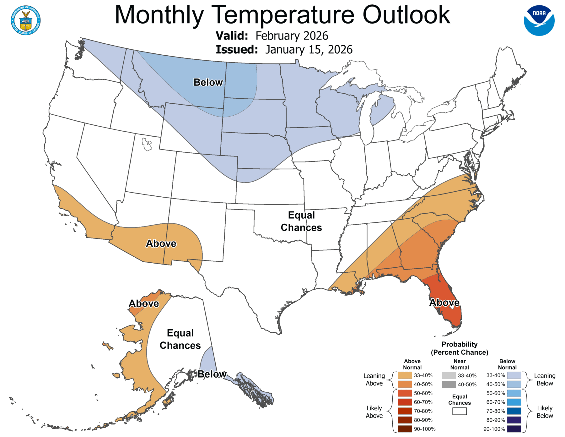
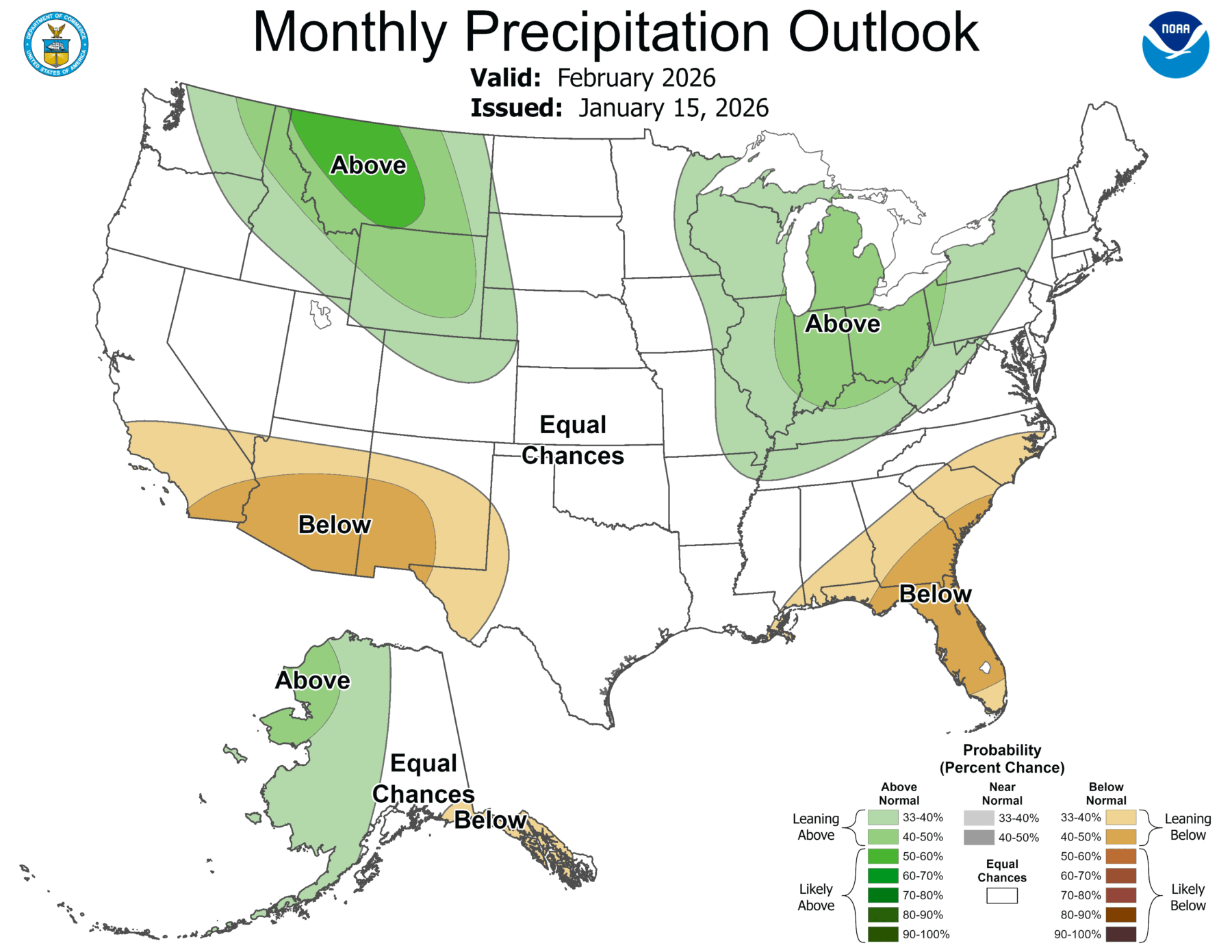
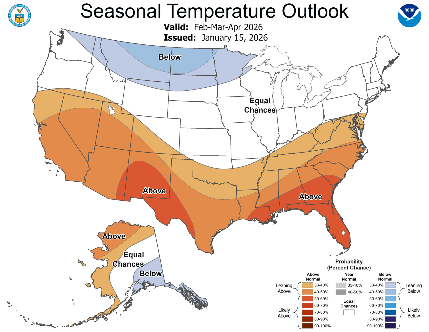
Earlier this week NOAA released the latest monthly and seasonal climate outlooks for the US. They show that the current pattern of warmer and drier conditions in the southern part of the region associated with the weak La Nina we are in now is likely to continue for the next few months. This lingering effect is expected to occur even if we officially swing from La Nina to neutral conditions. One impact from the continuation of this pattern is that the current drought that covers a lot of the dry region is expected to continue and may expand back into some areas that were temporarily removed from moderate drought due to the last rain event. The long-range climate forecast for May through July indicates that temperatures are likely to be warmer than usual and precipitation may be above normal. I am not sure why this is occurring but am guessing that they think the La Nina effects will linger long enough to allow some early-season tropical development before El Nino’s jet stream starts to shut down tropical development later in the Atlantic hurricane season.