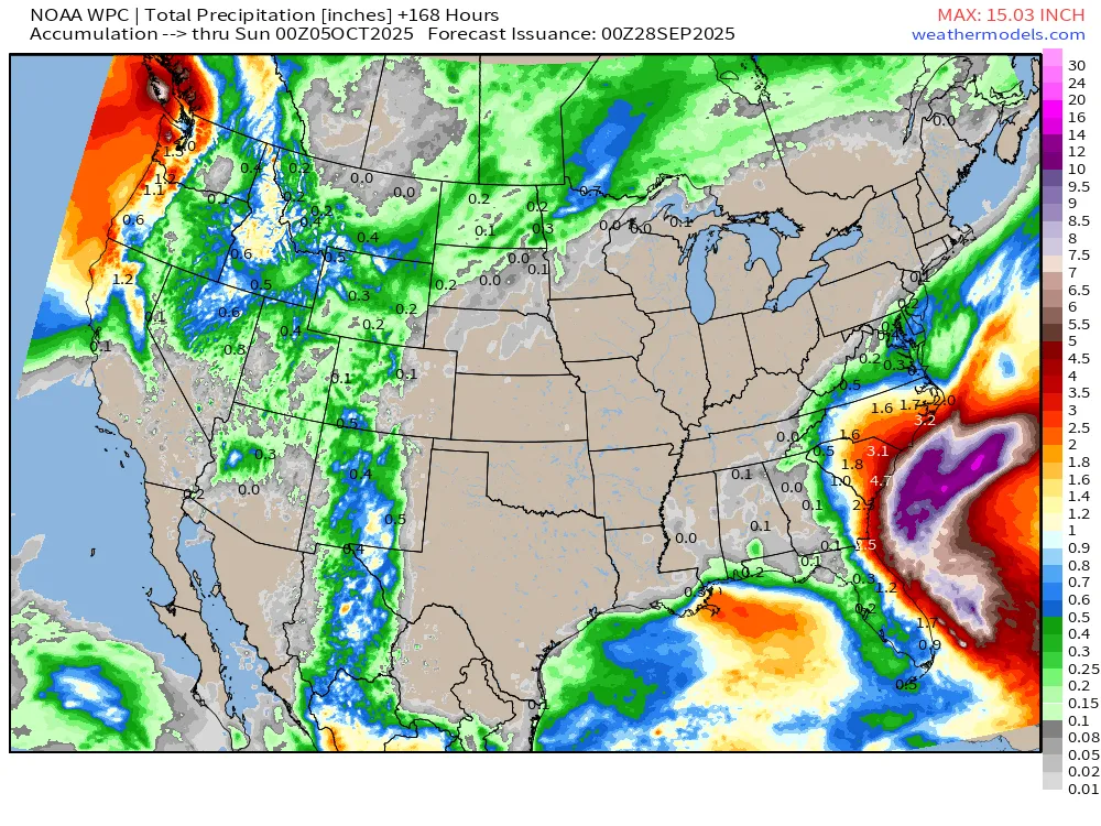
The latest 7-day rainfall map that is shown below from the Weather Prediction Center shows the amount of rain that is expected over the next week. By far the most rain is likely to come from what will soon be Tropical Storm Imelda, which is gathering strength in the Southern Bahamas and headed towards the Georgia and South Carolina coasts, although at this point it does not appear that it will make landfall before it turns east under the pull of the circulation around category 5 Hurricane Humberto. Still, there will be some rain from the circulation around Imelda, so parts of the region may see several inches of rain, but there will be a fairly sharp cutoff of the heaviest rain in central Georgia. Note that this map is based on current projections of where Imelda will go, so if the track shifts, so will the expected rainfall.
Once Imelda heads east, we don’t expect to see any significant rain for the next week. Temperatures are expected to be warmer than normal for the next week or so. That means the soil will continue to get drier and plants will experience more water stress. Weeks 3 and 4 look like they are a bit more likely to be wetter and cooler than it has been, but that is a long way off.