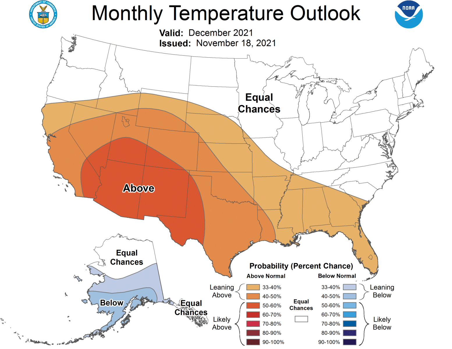
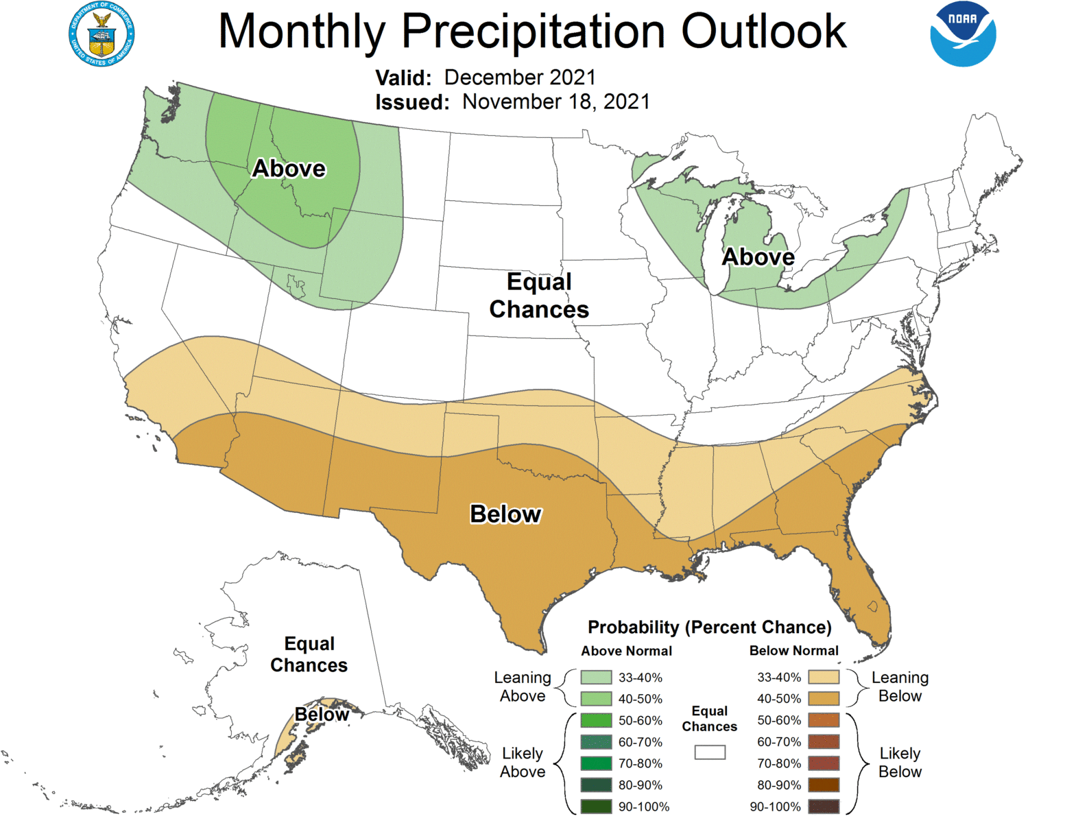
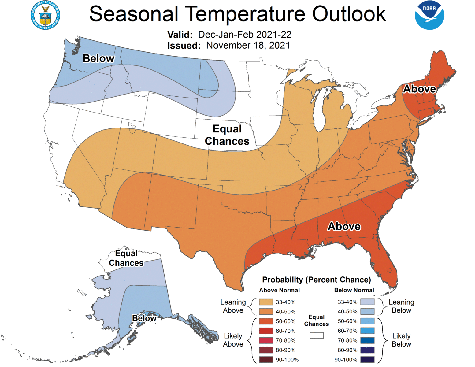
The latest seasonal climate outlook was released late last week by NOAA. It shows that in spite of the current cold conditions, temperature and precipitation patterns in the winter period from December through February are expected to be aligned with what we think of as typical La Nina patterns. That means warmer than normal temperatures across much of the southern US as well as drier than normal conditions, with the highest probabilities in Florida and along the southeastern coasts. Of course each La Nina is different so some variations may occur, but the odds of a typical La Nina pattern are high. The La Nina is expected to go away by late spring.