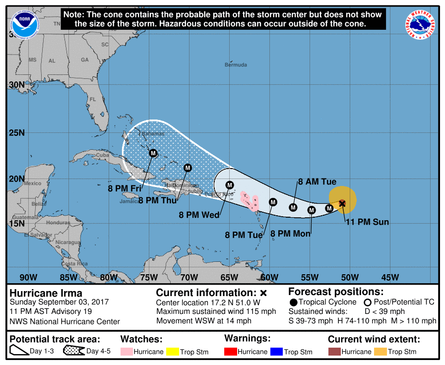
Many of my meteorologist friends of mine have been watching the progression of Hurricane Irma across the Atlantic for the last several days. There is a lot of hype out there on social media, and some people pushing clickbait have put out wildly speculative (or in some cases, just plain false) information.
However, in the last two days as the hurricane has moved closer, the various computer models are coming into better agreement about where it might go, and the Southeast is definitely in the higher probabilities for landfall. It is still possible it could recurve and not hit land at all, although it might come close to the East Coast and could provide strong surf, winds and rain even if the center never comes on shore. Or it could turn westward and enter the Gulf of Mexico, although this is not likely. The more likely paths take it somewhere across the Southeast in the time period roughly from September 10 to 14 (although that could also change as we watch the storm move). You can read more at https://www.wunderground.com/cat6/hurricane-watches-leeward-islands-irma-chugs-west?__prclt=pLE50RMw.
If you have not already prepared for a hurricane this tropical season, now is the time to get ready just in case Irma comes across your area. There are a number of sites that provide information on what you need in your hurricane kit. If you already have your kit, you should be watching your local meteorologist or accessing information from the National Hurricane Center regularly for updates on the storm. By Friday we expect it to be close enough to the US coast to have a much better idea of where or if it is likely to hit. Emergency managers and the National Weather Service local offices will provide more specific information for your location as time progresses.