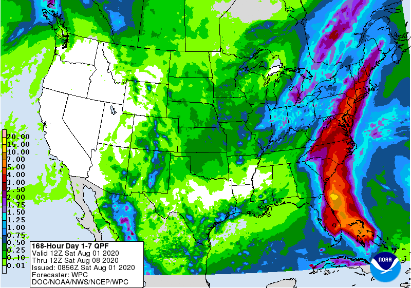
The latest 7-day QPF map shows the strong influence of Hurricane Isaias and its rain for the next 3-4 days along the East Coast. Areas near the center of the circulation could see several inches of rain, while areas to the west of it are likely to remain dry. The accuracy of this week’s map will strongly depend on the exact track of Isaias, so if the storm’s path is farther east than what is predicted this morning, the band of heavy rain will also move east. After Isaias passes, we should go back to our more typical summertime pattern of afternoon thundershowers. Early reports of the next tropical storm that is likely to develop are holding it well east over the Atlantic, so that probably won’t bring much rain to the Southeast.