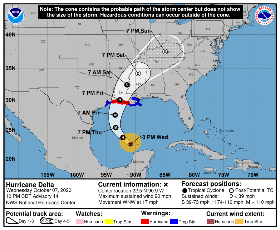
Hurricane Delta has now emerged from the Yucatan Peninsula and is moving back over open water in the Gulf of Mexico. It is expected to slowly strengthen for a while to a major hurricane again before weakening as it moves over colder water near the coast, which is caused by stirring up the water due to previous storms as well as runoff from the rains those storms were associated with. It is expected to make landfall on Friday during the day in western Louisiana. Once onshore, it should weaken to a tropical storm by Saturday morning and a post-tropical depression by Saturday night.
For parts of the Southeast, including Alabama, Georgia and the Florida Panhandle, rain will have the biggest impact. Rain amounts will generally be less than an inch near the coast, and 1-2 inches in northern AL and GA as the center of circulation moves through on Sunday. The rain in most of AL and GA will come intermittently as associated bands of showers move through the region. Some weak tornadoes may be observed in a few of the stronger storms in these arms. Rain will continue early next week along the East Coast as the remains of Delta move northeast past the Carolinas and Virginia.