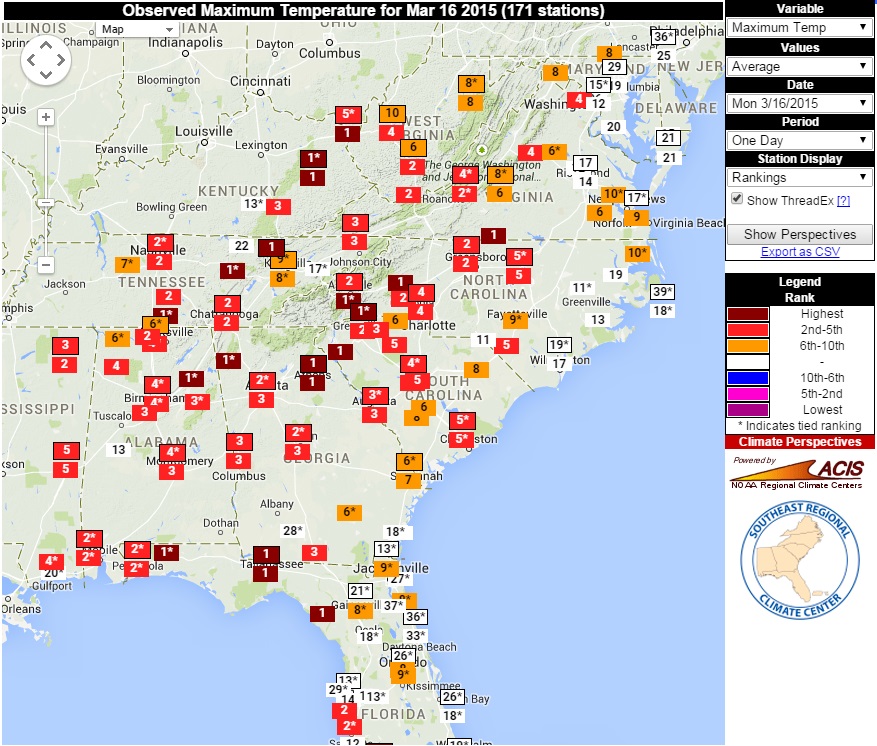
The beautiful weather yesterday set records across many parts of the Southeast. If you are interested in looking at the temperatures or rankings for yourself, the Southeast Regional Climate Center has a good tool called “Perspectives” which allows you to look at the recorded values of recent weather conditions and calculate the ranking of that value in historical context.
The map below shows the rankings of yesterday’s high temperatures for stations around the Southeast, indicating the large number of record and near-record temperatures in the region. Here is the link to the original map: https://www.sercc.com/perspectivesmap?date=2015-03-16&var=maxtemp&map_display=rank. If there are two numbers for a station, it’s because the bottom one is for just that station’s location and one is for the complete record for that city, which may include records from multiple stations moving around the area threaded together.