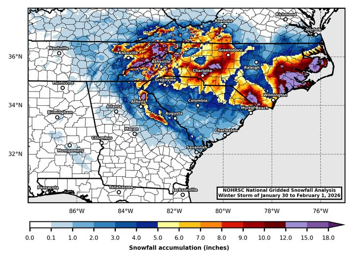
I have seen several snowfall maps of the snow that fell during the storm this past weekend put together by various television meteorologists and others. Here is one I like that was created using the NOHRSC National Gridded Snowfall Analysis by Jordan McLeod of the University of South Alabama that really captures the complexity of where the heaviest snow fell, including a band that occurred just east of Athens. I received 2.6 inches of snow on Saturday but friends just 20 miles east of us received 6 inches because a snow band set up right over them and dropped very heavy snow for hours. But that is nothing compared to the snow that fell along the North Carolina coast, where a few isolated areas of up to 20 inches were observed. I’ve also attached a satellite picture that shows the extent of snow on the ground in Georgia under clear skies today. You can see the streamers of cumulus clouds forming off the coast as the frigid air moves over the warm Gulf water, creating what we call “cloud streets”. Where the clouds moved over land along the west coast of Florida, there was even snow flurries as far south as For Myers. I saw from another Facebook post that the last time the entire state of South Carolina was covered with snow was back in 1899, which is really amazing.