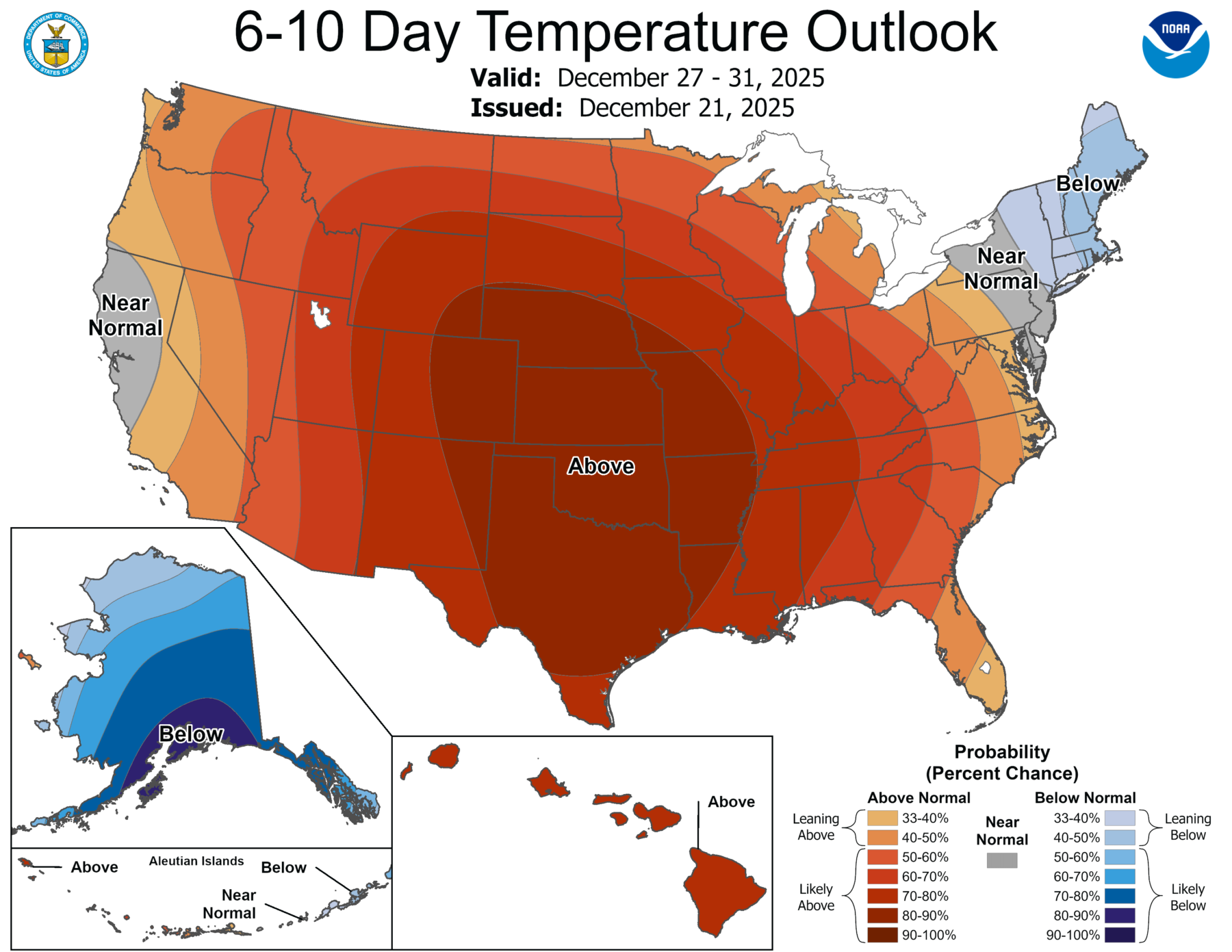
As we roll up to Christmas later this week, we can expect conditions that are not much like the average December 25 weather. A large area of high pressure is expected to stall in the middle of the Lower 48 states, keeping precipitation chances near zero and raising temperatures to near record-setting levels. Here in Athens as well as most of Georgia, temperatures at the end of the week, including Christmas Day, may be in the 70s. It probably won’t break records, which are in the upper 70s, but it will still be in the top 10 warmest Christmases on record. What is more amazing is that the 70s may go as far north as Kansas and potentially even farther north. Because of the high pressure, any chance of rain will be very small, which could cause drought conditions to expand again (in addition to the effects of the hot weather). These conditions are likely to continue well into January across most of the region. So no White Christmas for us this year, not even in the highest elevations. Even my home town of Grand Rapids MI, right in the Lake Michigan snow belt, is probably going to lose what snow they have and is going to look mighty green by Christmas.