The content on this page is retained only for recordkeeping, historical reference, or research. These materials are preserved in their original form and may not meet current WCAG 2.1 AA accessibility standards.

These archived materials are not required to be remediated. However, we remain committed to equitable access. If you need an accessible version of any archived item to participate in our current programs and services, we will provide one when feasible upon request at caesweb@uga.edu.

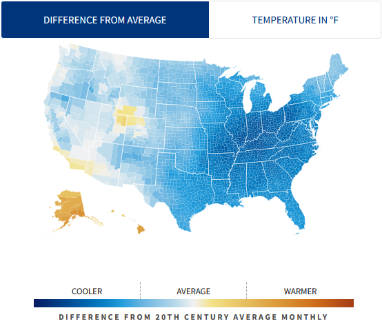
Here is a website that has monthly temperature and precipitation maps for the continental US going back to the 1920s. You can use it to look up what the anomalies and extreme climate were for any month since then. Just for fun I produced the map below showing the extent of extremely cold temperatures that occurred in January 1977 when I was in college in Michigan. I did not realize the expanse of cold conditions covered most of the US! You can try it out at https://usafacts.org/issues/climate.
.