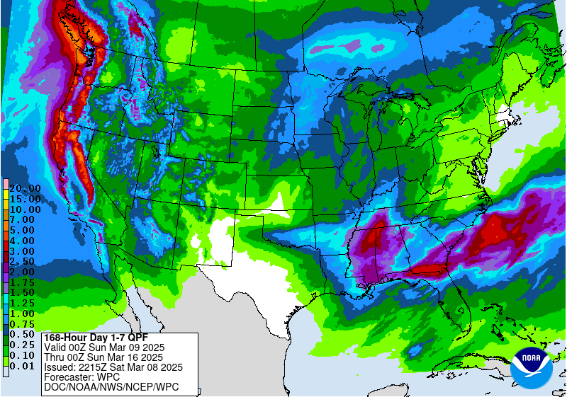
The latest 7-day QPF map shows two areas where heavy rain of up to 5 inches will fall in the next week. In the next two days, a band of heavy rain will occur along and just north of the Georgia-Florida border. This could result in flooding of fields and washing out of any newly planted corn or applied fertilizer in those locations. The middle of the week is expected to be mainly dry with just a few showers. Late in the week, another storm will move through Mississippi and western Alabama and could bring up to 5 inches in the northwestern corner of the state. These rain events should help to reduce the drought conditions, especially the first storm since it will occur before the data cutoff for the next drought map.