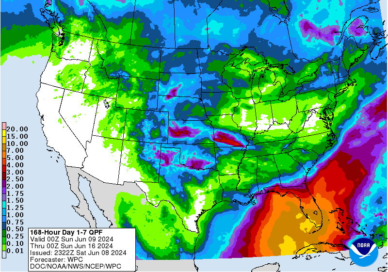
The latest 7-day QPF map shows that while most of the region will be relatively dry, the Florida Peninsula could see multiple inches of rain this week due to a change in the weather pattern that will allow warm moist air to move across the Peninsula starting later this weekend. The National Hurricane Center is not showing any indication that a tropical storm or hurricane will form, but a wet, sloppy system could still move across Florida this week with enough rain to cause significant impacts. If you are in counties that border Florida in southern GA and AL and southern SC, you are likely to see significant rain later in the week. Folks in Florida could measure rains of up to 15 inches along the SW coast with most of the state receiving at least 3 inches. This will make a dent in the worsening drought there.
Flooding is likely to cause problems for citrus and vegetable farms because that much rain just cannot sink in or run off quickly enough. Rainfall in Florida is likely to be above normal for the next four weeks, so their winter dry season has definitely ended.