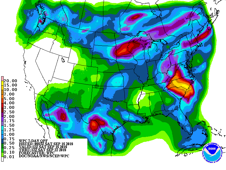
The latest 7-day QPF map shows the continuing presence of now Tropical Storm Florence as it slowly drifts to the SW before it turns west later today. The rainfall for the next seven days is mainly due to Florence except in Florida, where regular scattered daily thundershowers are expected to occur all week. Once Florence moves out, midweek is expected to be dry for most of the Southeast, then shower activity will increase late in the week, although amounts are still expected to be low. Of course, if Florence does not move as expected, the rainfall this week will also shift, so keep an eye on the forecasts and the radar.