The content on this page is retained only for recordkeeping, historical reference, or research. These materials are preserved in their original form and may not meet current WCAG 2.1 AA accessibility standards.
These archived materials are not required to be remediated. However, we remain committed to equitable access. If you need an accessible version of any archived item to participate in our current programs and services, we will provide one when feasible upon request at caesweb@uga.edu.
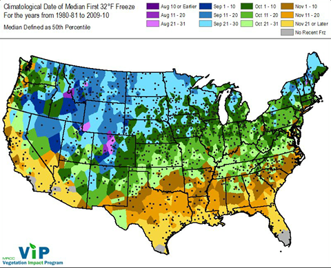
A post on Facebook this morning reminded me that it is time to start thinking about fall frosts and freezes. Fortunately from a frost perspective, the next few weeks look like they will be above normal in temperature so we are likely to see a later than average date for the first frost, but even in a period with warm temperatures, a cold night can still sneak in. This map of the median first 32 F freeze is from the Midwestern Regional Climate Center.