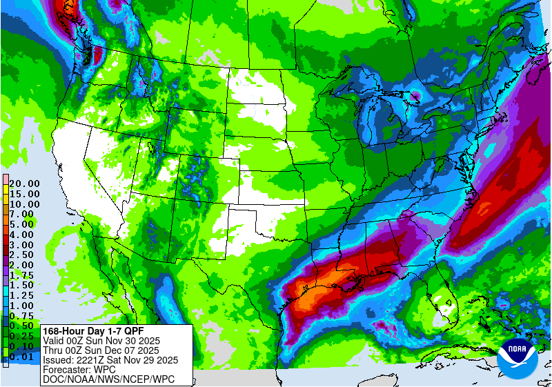
This week, most of the region can expect to see an inch or more of rain, a big change from the last couple of months. The only exception is the Florida Peninsula, which will be south of the rain-producing weather and will get little to no rain. The first round of rain started today in Alabama and will be moving through the region over the next couple of days. Some areas could see 2-3 inches of precipitation from this storm. Dry conditions will dominate in the middle of the week but rain will return late in the week due to a low pressure area along a front draped along the Florida Panhandle as well as southern Alabama and Georgia and up the East Coast. This rain will halt the expansion of drought and there may be some small improvements but won’t be enough in the most extreme areas to show any improvement in next week’s Drought Monitor.