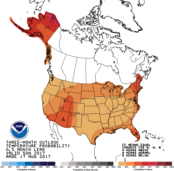
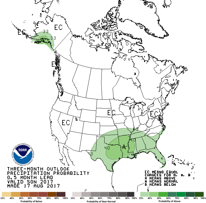
The latest outlooks for September and for fall and winter from the Climate Prediction Center are out and show that September is expected to be cooler than normal in inland areas of the Southeast, especially in the first half of the month. It should be warmer than normal in the Florida peninsula with equal chances of above, near or below normal in between during September. The entire Southeast is expected to be wetter than normal in September.
For the fall months of September through November, the region is leaning towards above normal temperatures based on long-term trends in spite of the likelihood of a cold September. Areas along the Gulf of Mexico are expected to continue to be above normal in rainfall. This is most likely due to the heavy rains that are still falling from Harvey, which will provide ample soil moisture for the development of frequent rain showers over the area and which will also enhance the precipitation which comes with any frontal passage that occurs.
With neutral conditions expected to continue through the winter, there is not a strong signal for determining what the climate will do. However, the trend towards warmer temperatures is expected to continue and an area of drier than normal tendencies is also shown for the southern part of the region.
In neutral winters, conditions tend to be more variable than in either La Niña or El Niño years. This could lead to more chill hours for fruit, but could also contribute to the possibility of a late-season frost.