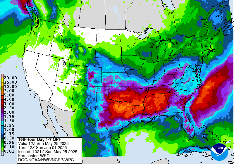
Hope you are all having a good Memorial Day weekend! I am up in Michigan visiting my mom this weekend but will be on the road tomorrow. Not much rain in the forecast here, but we expect more in the Southeast. A line of storms worked its way through overnight and is still working its way through southern GA and SC. Another one is on the way today moving through western TN towards the southeast. We expect to see more rain through the week with the driest period late in the week and into next weekend. The wettest part of the region will be Alabama and northwest Georgia with smaller amounts in the rest of Georgia and SC and down along the middle of the Florida Peninsula.
In the first week of June, the interior of the region is likely to continue to experience cooler than normal temperatures but areas along the Gulf Coast and in the Florida Peninsula will see warmer and wetter conditions than normal, with an increased chance of heavy rains. Weeks 3 and 4 continue to show wetter than normal conditions are likely but there is no trend towards a particular temperature pattern. So far there is no sign of any tropical development in the Atlantic or Gulf through mid-June but there is an area of interest in the Eastern Pacific Basin that could become the first named storm there this year.