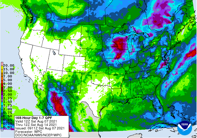
The latest 7-day QPF map shows that most parts of the region will get little rain in the next week, which is sure to make farmers in most areas happy after all the rain we have been seeing. The wettest area will be the Florida peninsula and the Virginia and North Carolina coasts, especially in the early part of the week. By mid-week, rainfall should be reduced to light and scattered showers in most areas. Temperatures will be increasing along with the sunshine. While the tropics won’t affect us this week, they are starting to get active again, with three areas of interest highlighted by NOAA, so we can expect to see more rain return in a couple of weeks as the tropics fire up.