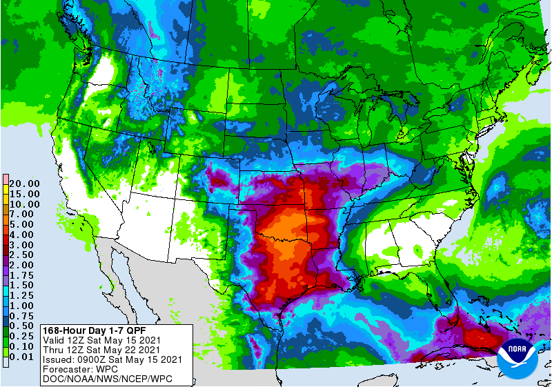
The next week looks dry for most of the Southeast, with the exception of light showers in the Carolinas and heavier rain on the southern tip of Florida. The big action is going to be to our west, where several inches could fall in Texas and Oklahoma over the next few days. A big ridge of high pressure should hold things out of the Southeast. The extended-range models are starting to show some signs of tropical activity, but you can’t really trust them too much at this point. Still, if you have not done your pre-planning for the tropical season, it’s time to do it now.