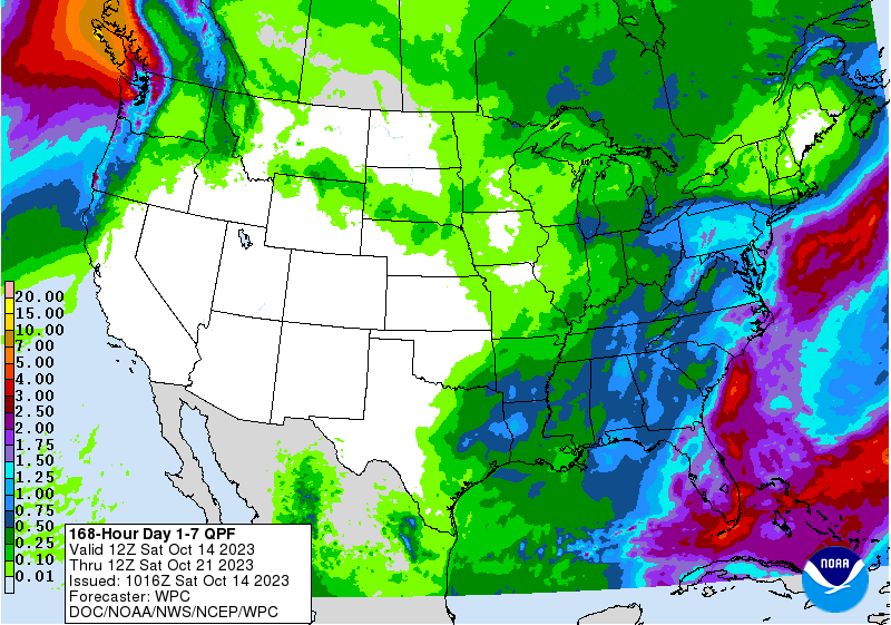
The latest 7-day QPF map shows that now that this week’s rain is moving out to the northeast, it should be dry until late in the week when the next system brings rain back to the region except for a few small spots in southern FL and in Virginia. All the rain you see on the map below will fall on Thursday and Friday. Temperatures should be cooler for the next few days after the cold front moves through later on Saturday, but I see only the slightest hint of near-freezing temperatures for the rest of the month in the mountains, so widespread frost and freezing conditions are not a concern at this time, although we will keep watching.