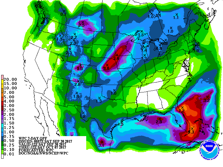
The latest 7-day QPF map shows that most of the Southeast will be dry again this week with a strong high pressure center over us. A front stalled across the Florida panhandle will bring rain to that area as well as along the coasts, and a tropical system may form along the front and increase the rain there. The dry conditions are good for harvest but not good for producers trying to plant small grains and winter forage or hoping for their peanuts to fill out. Unfortunately, the pattern for the next two weeks looks like above normal temperatures and drier than normal conditions will continue.