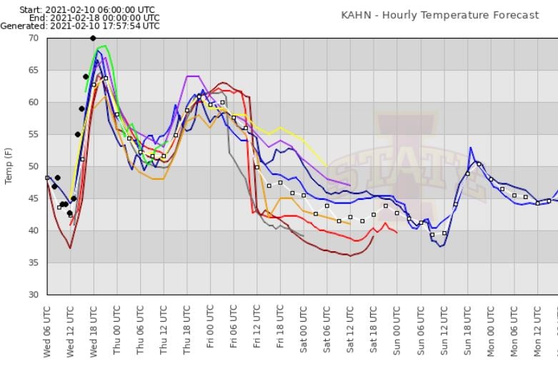
Have you noticed the the recent weather forecasts have not been very good and certainly not very consistent for the past few weeks? Today’s warm temperature of 74 F in Athens was much higher than the morning forecast, which called for cooler temperatures in the 60’s and cloudy skies. The computer models that they use in forecasting are having a tough time dealing with the recent unusual weather patterns we have been seeing. The result of that is forecasts that can swing wildly between extremes as new model runs come in and projections of where fronts will set up shift over time. Kirk Mellish of WSB provides a look at some of the reasons for the forecast uncertainty in his blog here.
The graph below shows the various model forecasts for Athens earlier today along with the actual observations as black dots put together by my husband John Knox for his weather forecasting class at UGA. Forecasters are always trying to learn from their mistakes!