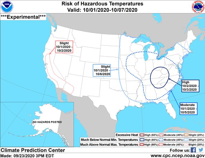
While we can’t predict exact temperatures more than a week out, we are starting to get a hint from medium-range weather models that a significant outbreak of cold air will move into the Southeast early in October. In particular, the nights of October 2-4 could see temperatures into the 30’s across the Southern Appalachians and into northern GA and AL and western NC and SC. In most places the temperature probably won’t get down to freezing, but if you have areas that are frost pockets and prone to frost before anywhere else, those areas could freeze. The longer-range models show a second outbreak the second week of October, but we don’t have a lot of confidence in those models. It’s still a ways off, so the predictions are likely to change somewhat in strength and timing, but something to keep an eye on if you have tender plants that could be impacted by the cold air. You can view these probabilistic threats at https://www.cpc.ncep.noaa.gov/products/predictions/threats/threats.php.